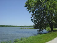
In Osage County, Kansas, a US Army Corps of Engineers dam causes the river to form Melvern Lake, which is the site of Eisenhower State Park.
Floods
The Marais des Cygnes River has a history of flooding. One of the first such floods that has been noted is the Great Flood of 1844 known as "Big Water" in Native American legend. Though no measurements were taken, it is estimated to have crested at 40 feet.
After the 1844 flood, there were many floods, and some of the more notable ones include the 1909 flood, cresting at 36.3 feet; the 1915 flood, cresting at 31 feet; the 1928 flood, cresting at 38.65 feet which was a record until the 1951 flood; and the 1944 flood, cresting at 36.5 feet.
One of the most famous happened in the months of June and July 1951, is the Great Flood of 1951 which crested at 42.25 feet. 41 people were killed and was estimated to cost millions worth of damage. Other rivers that were affected by the flood are the Kansas River and Neosho River.
As a result of the 1951 floods, the U.S. Army Corp of Engineers built levees and flood control systems on the Marais des Cygnes in the 1960s. These levees and pumping stations would help minimize the effects of a major flood.
Further information from the Hillsdale Water Quality Project, Inc
The Marais des Cygnes Basin is a vital natural resource, providing drinking water and other domestic uses including municipal and industrial uses, recreational opportunities, agricultural benefits, wildlife habitats and other benefits to thousands of residents in portions of 13 counties in east central Kansas. The basin is characterized by increasing development expanding from the Kansas City area; growing recreational demands and municipal needs; a robust agriculture comprised of feed grain production, grazing lands, and confined animal feeding operations, especially dairy and beef cattle; and critical wildlife habitat, including the Marais des Cygnes Wildlife Area, a natural wetland providing habitat for migratory waterfowl.
The 1990 total population for the Marais des Cygnes Basin in Kansas was 110,023. The Kansas Water Office projects an increase to 177,000 by 2040. Similar growth is taking place in Missouri. The Marais des Cygnes Basin includes four HUC-8 subwatersheds: Upper Marais des Cygnes (10290101), Lower Marais des Cygnes (10290102), Little Osage (10290103) and Marmaton (10290104).
Watershed planning has occurred throughout this basin. During 2002, several local Kansas entities conducted TMDL educational efforts. The Lake Region RC&D and K-State Research and Extension offices co-sponsored public tours and a workshop to develop a Watershed Restoration Action Plan. During those sessions, residents identified the basin’s water resources, determined watershed threats and defined opportunities for restoration. A watershed protection plan was completed for Melvern Lake’s 223,360-acre watershed. A Hillsdale Watershed Resource Plan, for the 92,000-acre watershed, has also been completed
Identified impairments in the basin’s streams include: dissolved oxygen, nutrient loading and fecal coliform bacteria. Low dissolved oxygen levels typically coincide with an abundance of algae and are associated with heavy organic matter and nutrients. Sources of fecal coliform bacteria found in the streams are human and warm-blooded animal waste. The impairments in the basin’s lakes include eutrophication, excessive biomass and sediment.