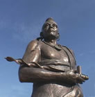
The region claimed by the Kanza Nation was ceded to the United States by the treaty of June 1825. The Missouri Shawanoes (or Shawnees) were the first Indians removed to the territory set apart for emigrant tribes by the treaties of June, 1825. The Kanzas and Osages were relocated later. The only Native American to reach the Vice Presidency of the United States was Charles Curtis, under Herbert Hoover (1929–1933). His mother was a Kaw.
The Curtis Act, named for the Congressman and future Vice-President who sponsored it, in 1898 expanded the powers of the federal government over American Indian affairs. An act of congress in 1902 disbanded the Kaw tribe as a legal entity. This act transferred 160 acres (0.6 km²) to the federal government and about 1,625 acres (6.6 km²) of Kaw land to Curtis and his children.
The federal land was used to found the city of Washungah, Oklahoma. The Kaw Nation of Oklahoma later regained recognition and is currently located in Kaw City, Oklahoma. The U.S. jazz saxophonist, singer, and composer Jim Pepper (1941-1992) was of both Kaw and Creek ancestry. On April 23, 2000 the last Kaw fullblood, William A. Mehojah died: and, the Allegawaho Memorial Heritage Park (AMHP) was dedicated on June 19, 2005 near Council Grove, Kansas.
An Early History of the Kaw (Kanza) Tribe
by William G. Cutler (1883)
From a period extending far back into the past--far back of any written record--the Kanzas claimed, as a nation, the region that they ceded to the United States by the treaty of June, 1825. From the time that Father Marquette inscribed the name of the "Kanza" nation on his map of 1673, a half- century elapses before the name again appears; when especial mention of the "Canzas" is made by M. de Bourgmont, commander at Fort Orleans, who passed directly through Kansas from east to west, and north of the Kansas River in 1724, on his expedition to the Padoucas, in the West. He was accompanied by delegations from several Eastern tribes, consisting of their principal chiefs and warriors. Conspicuous among these was the "Canzas" delegation--the general rendezvous for the other tribes being at the Canzas village on the Missouri. The hospitality of the tribe, and their generous treatment of their visitors, is especially noted by Monsieur de Bourgmont in his journal.
There were formerly two Kanzas villages on the Missouri River. The lower, about forty miles above the junction of the Kansas and Missouri, was situated on the west bank of the river, between two high bluffs; the upper was a little above the mouth of Independence Creek, on the south bank of the river, and is described as having been located on "an extensive and beautiful prairie." It was called the "Village of the Twenty-four."
When Capt. Lewis, of the Lewis and Clarke expedition, visited the sites of these old villages in 1804, every trace of the lower had disappeared; but on a hill, a little in the rear, were the remains of an old French fort, of which the general outline of fortification and the ruins of the chimneys were plainly discernible. A fine spring of water was found in the vicinity. There is no clue to the history of the parties who built or occupied the fort, but the supposition is that they were destroyed by the Indians. Enough of the remains of the upper village could be distinguished to show that it was quite extensive.
The Kanzas were driven from their settlements on the Missouri by the inroads of the Iowas and Sacs, who, by reason of their intercourse with the traders of the Mississippi Valley, were tolerably well supplied with firearms. The exact time at which this occurred is not known, but it was probably thirty years before the visit of Capt. Lewis, as the Osages were driven from the Missouri by the Sacs, and forced farther south, onto the Osage, about that time. After the incursion of the hostile Indians, the Kanzas, considerably reduced in number, located their principal village on the north bank of the Kansas River, about two miles below the confluence of the Big Blue.
The site of this village was surveyed and mapped in the spring of 1880, under the supervision of Judge F. G. Adams, secretary of Kansas Historical Society. He describes the locality as follows: "The site is in Pottawatomie County, about two miles east of Manhattan, on a neck of land between the Kansas and Big Blue Rivers. The rivers here by their courses embrace a peninsular tract of about two miles in length, extending east and west. At the point where the village was situated, the neck between the two rivers is about one-half mile in breadth, and the village stretched from the banks of the Kansas River northward for the greater part of the distance across toward the Blue. The site of the village is on the present farm of Hon. Welcome Wells, and is crossed by the Kansas Branch of the Union Pacific Railroad."
Although the Kanzas and Osages were of the same nation, their language nearly identical, and their government and customs similar, they were almost continually at war, from the time they were first known to Europeans until 1806, in which year a treaty was negotiated between the two nations through the instrumentality of the United States Government. A grand council was held September 28, 1806, at the village of the Pawnee Republic, between Lieuts. Pike and Wilkinson on the part of the United States, and various chiefs of the Pawnee, Osage and Kanzas nations. The treaty formed between the two nations at that time, copies of which were forwarded to the several tribes through their respective chiefs, read as follows:
"In council held by the subscribers, at the village of the Pawnee Republic, appeared Wahonsongay with eight principal soldiers of the Kanses (sic) nation on the one part, and Shinga-Wasa, a chief of the Osage nation, with four of the warriors of the Grand and Little Osage villages on the other part. After having smoked the pipe of peace and buried past animosities, they individually and jointly bound themselves in behalf of and for their respective nations to observe a friendly intercourse and keep a permanent peace, and mutually pledge themselves to use every influence to further the commands and wishes of their great father. We, therefore, American chiefs, do require of each nation a strict observance of the above treaty, as they value the good will of their great father, the President of the United States. Done at our council fire, at the Pawnee Republican village, the 28th of September, 1806, and the thirty-first year of American independence.
(Signed),
Z. M. Pike
J. B. Wilkinson.
The treaty thus formed was never broken by either nation, their common hostility being henceforward directed mainly to the Pawnees, and the marauding tribes that infested the Western plains.
The Kanzas nation, although smaller numerically than either the Osage or Pawnee, was more warlike than the former, and, from its rapidly acquired skill in the use of firearms, was dreaded by the latter. It was not many years after the visit of Lieut. Pike before the increasing influx of traders and explorers into the country gave a new direction to the warlike propensities of the tribe, which, from its position, was able to cause much trouble and annoyance, both to those who sought to pass up the Missouri and those who wished to cross the plains to the Rocky Mountains.
Their depredations becoming more frequent and serious, culminated in 1819, by their firing on one of the Indian Agents, and attacking and plundering soldiers attached to the command of Capt. Martin, who was sent up the Missouri with a detachment of troops the preceding fall, and was obliged, during the winter, to form a hunting-camp, to keep himself and party from starving. To prevent the recurrence of similar outrages, Maj. O'Fallon, the Indian Agent who had been attacked, summoned the chiefs and principal men of the Kanzas nation to a council, to be held at Isle au Vache, in the Missouri River, near the present site of Atchison, on the 18th of August, 1819.
The Indians were absent on a hunting excursion when the messenger arrived at their village on the Kanzas, but arrived at the designated place on the 23rd, and on the following day, the council was held in the arbor prepared for their reception. There were present 161 Kanzas and thirteen Osages, including Na-he-da-ba, or Long Neck, one of the principal chiefs of the Kanzas; Ka-he-ga-wa-ta-ning-ga, Little Chief, second in rank; Shen-ga-ne-ga, an ex-principal chief; Wa-ha-che-ra, Big Knife, a war chief; and Wom-pa-wa- ra, or White Plume, just then becoming famous. Maj. O'Fallon had with him the officers of the garrison and a few gentlemen connected with Maj. Long's exploring expedition.
After setting forth the various grievances which the whites had suffered at their hands, and impressing them with a sense of their general bad conduct, which they were assured richly merited severe chastisement, the Major held out the promise of reconciliation, provided their future behavior should merit such a favor.
The chiefs fully acquiesced in the justice of the charges brought against them, and accepted the terms offered by the agent. The ceremonies were enlivened by a slight military display in the form of firing of cannon and hoisting of flags, and an exhibition of rockets and shells, which last evidently made a deeper impression on the minds of the visitors than the eloquence of Maj. O'Fallon. It was afterward learned that the delegation would have been larger but for a quarrel which arose among the chiefs after they had started, in regard to precedence in rank, in consequence of which ten or twelve returned to the village.
Prof. Thomas Say, of Maj. Long's exploring party, visited the nation at the village on the Kansas River during the summer of 1819, being there when the delegation started for the Isle au Vache council. The following account of the reception of his party; of the general appearance of the village, and of the government and customs of the nation at the time, is taken from the report of Maj. Long's expedition. Speaking of Mr. Say's party, the report says:
"As they approached the village, they perceived the tops of the lodges red with the crowds of natives. The chiefs and warriors came rushing out on horseback, painted and decorated and followed by great numbers on foot. Mr. Say and party were received with the utmost cordiality, and conducted into the village by the chiefs, who went before and on each side to protect them from the encroachments of the crowd. On entering the village, the crowd readily gave way before the party, but followed them into the lodge assigned to them, and completely and most densely filled the spacious apartment, with the exception only of a small space opposite to the entrance, where the party seated themselves on the beds, still protected from the pressure of the crowd by the chiefs, who took their seats on the ground immediately before them. After the ceremony of smoking with the latter, the object which the party had in view in passing through their territories was explained to them, and seemed to be perfectly satisfactory. At the lodge of the principal chief, they were regaled with jerked bison meat and boiled corn, and were afterward invited to six feasts in immediate succession."
Mr. Say writes as follows:
"The approach to the village is over a fine level prairie of considerable extent, passing which you ascend an abrupt bank to the right, of ten feet, to a second level, on which the village is situated in the distance, within about a quarter of a mile of the river. It consists of about one hundred and twenty lodges, placed as closely together as convenient, and destitute of any regularity of arrangement. The ground area of each lodge is circular, and is excavated to the depth of from one to three feet, and the general form of the exterior may be denominated hemispheric.
The lodge in which we reside is larger than any other in the town, and being that of the grand chief, it serves as a council-house for the nation. The roof is supported by two series of pillars, or rough vertical posts, forked at the top for the reception of the transverse connecting pieces of each series; twelve of these pillars form the outer series, placed in a circle, and eight longer ones the inner series, also describing a circle; the outer wall, or rude frame-work, placed at a proper distance from the exterior series of pillars, is five or six feet high. Poles, as thick as the leg at the base, rest with their butts upon the wall, extending on the cross-pieces, which are upheld by the pillars of the two series, and are of sufficient length to reach nearly to the summit. These poles are very numerous, and agreeable to the position which we have indicated, they are placed all around in a radiating manner, and support the roof like rafters. Across these are laid long and slender sticks or twigs attached parallel to each other by means of bark cord; these are covered by mats made of long grass or reeds, or with the bark of trees; the whole is then covered completely with earth, which, near the ground, is banked up to the eaves. A hole is permitted to remain in the middle of the roof to give exit to the smoke. Around the walls of the interior a continuous series of mats are suspended; these are of neat workmanship, composed of a soft reed, united by bark cord, in straight or undulated lines between which lines of black paint sometimes occur. The bedsteads are elevated to the height of a common seat from the ground and are about six feet wide; they extend in an uninterrupted line around three-fourths of the circumference of the apartment, and are formed in the simplest manner, of numerous sticks or slender pieces of wood, resting at their ends on cross pieces, which are supported by short notched or forked posts driven into the ground. Bison skins supply them with a comfortable bedding. Several medicine or mystic bags are carefully attached to the mats of the wall; these are cylindrical, and neatly bound up. Several reeds are usually placed upon them, and a human scalp serves for their fringe and tassels. Of their contents we know nothing.
The fire-place is a simple, shallow cavity in the center of the apartment, with an upright and a projecting arm for the support of the culinary apparatus. The latter is very simple in kind and limited in quantity, consisting of a brass kettle, an iron pot and wooden bowls and spoons. Each person, male as well as female, carries a large knife in the girdle of the breechcloth behind, which is used at their meals, and sometimes for self-defense. During our stay with these Indians, they ate four or five times each day, invariably supplying us with the best pieces, or choice parts, before they attempted to taste the food themselves."
Their food is described as consisting of bison meat, and various preparations of Indian corn or maize, one of which was called "lyed corn," known among the whites as hulled corn. They also used pumpkins, muskmelons and watermelons, and a soup made of boiled sweet corn and beans, and seasoned with buffalo meat.
In 1819, the hereditary principal chief was Ca-ega-wa-tan-ninga, but could maintain his authority only by the force of personal qualities; all distinction, civil as well as military, being a reward for bravery or generosity. There were several inferior chiefs, but they possessed little authority.
Like all the Indian tribes, the Kanzas believed in a Great Spirit, and had vague ideas of a future life. In their family relations they were more honorable than many of the Eastern tribes. Marriage was celebrated with such ceremonies as served to render the tie more binding, and chastity was one of the requisites to fit a woman for the "wife of a chief, a brave warrior or a good hunter." They bore pain with the common Indian stoicism, never complaining. They were faithful to the ties of relationship and friendship, and cared for the sick and disabled. Drunkenness was rare, and insanity unknown. The women had entire management of all domestic concerns, and appeared to take pride in excelling in that department.
The first treaty between the United States Government and the Kanzas Indians was made and concluded between Ninian Edwards and August Choteau, Commissioners of the United States, and certain chiefs and warriors of the Kanzas tribe, on behalf of said tribe, in the year 1815. It was a treaty of peace, the parties mutually agreeing to forgive any past injury, to perpetuate friendly relations, and the tribe, through its chiefs, acknowledging itself under the protection of the United States and of "no other nation, power or sovereign whatsoever."
In June, 1825, treaties for the cession of their lands were made with the Kanzas and Osage nations at St. Louis, Mo. These treaties were made by Gen. Clarke, Superintendent of Indian Affairs, without previous authority from the Government, but by the advice of Hon. Thomas H. Benton, and on the strength of his assurance that they would be ratified by the Senate. They were duly ratified, and the necessary appropriations made. The treaty with the Kanzas was made June 3, 1825, by the terms of which the following named country was ceded:
"Beginning at the entrance of the Kansas River into the Missouri River; from thence north to the northwest corner of the State of Missouri; from thence westerly to the Nodaway River, thirty miles from its entrance into the Missouri River; from thence to the entrance of the Nemaha into the Missouri River, and with that river (the Nemaha) to its source; from thence to the source of the Kansas River, leaving the old village of the Pania (Pawnee) Republic to the west; from thence on the ridge dividing the waters of the Kansas River from those of the Arkansas, to the western boundary line of the State of Missouri; and with that line thirty miles to the place of beginning."
From this cession a reservation "for the use of the Kanzas nation" was made of a "tract of land, to begin twenty leagues up the Kanzas River and to include their village on that river; extending west thirty miles in width, through the lands ceded in the first article."
About twenty half-breed reservations of one mile square were made "to be located on the north side of the Kanzas River, commencing at the line of the Kanzas Reservation" (a little west of the present site of North Topeka) "and extending down the Kanzas River for quantity."
The tribe also relinquished at this time all claim they might have to lands in Missouri; and in consideration of the cession of land, and relinquishment of such claim, the United States agreed "to pay to the Kanzas nation of Indians $3,500 per annum for twenty successive years, at their villages, or at the entrance of the Kanzas River, either in money, merchandise, provisions or domestic animals, at the option of the aforesaid nation; and when the said annuities, or any part thereof, is paid in merchandise, it shall be delivered to them at the first cost of the goods in St. Louis, free of transportation.
In addition to the above-named consideration, cattle, hogs, and implements of agriculture were to be supplied to them, a blacksmith provided, and persons employed to teach them agriculture.
The United States, by its Commissioner, also agreed that "thirty-six sections of good land, on the Big Blue River, shall be laid out under the direction of the President of the United States, and sold for the purpose of raising a fund to be applied, under the direction of the President, to the support of schools for the education of the Kanzas children within their nation."
A part of the first payment was made at St. Louis, at the time of the treaty; $2,000 in merchandise and horses being delivered to the deputation of chiefs and warriors present; the remainder was paid at the mouth of the Kansas River, near the present site of Wyandotte, during the year 1825.
The first Kanzas Agency was established at what is now East Kansas City, in 1827, Barnett Vasquez being the first agent. The agency was removed to the mouth of Grasshopper Creek the following year, the first payment at that point being in 1829--Daniel McNair, Special Agent and Paymaster. In 1830, Marston G. Clark, Agent; Daniel Boone, farmer; Clemenent Lessent, Interpreter; Gabriel Phillibert, blacksmith; with some of the Kaw half-breeds, were living at the "Stone Agency House," on Grasshopper Creek.
The old Kanzas village near the mouth of the Big Blue was partially abandoned about the year 1830; the tribe, during that year, establishing several villages lower down the Kansas River. The village of American Chief was on the creek of the same name (now Mission Creek), and about two miles south of the Kansas River. This band, of about one hundred, had some twenty dirt lodges, of good size, in which they lived until they removed to Council Grove in 1848. Hard Chief's village, about a mile from the former, was situated on a high bluff on the south bank of the Kansas River, and numbered about five hundred people and eighty-five lodges. It was about a mile and half west of Mission Creek.
The third and largest village, that of Fool Chief, was on the north bank of Kansas River, two or three miles west of where North Topeka now stands. Mr McCoy, in his "Annual Register of Indian Affairs" for 1835, says the Government of the United States had at that time fenced twenty acres of land, plowed ten acres, and erected for the principal chief a good hewed-log house, at the lower or Fool Chief's village; their smithery, agency house and house for the residence of their teacher of agriculture being within the Delaware country, twenty-three miles east of the Kanzas lands. Mr. McCoy gives the whole number of the tribe as about 1,606, their agent then being R. W. Cummings, and their interpreter Joseph James. In 1830, Rev. William Johnson, Howard County, Mo., was appointed, by the Missouri Methodist Conference, missionary to the Kanzas tribe. He resided among them two years; was then transferred to the Delaware Mission; thence to the Shawnee, and, in 1835, returned to his labors among the Kanzas. In the spring of the same year, the Government farm was removed to the vicinity of the upper villages, three hundred acres being selected for the purpose on the north bank of the Kansas River, just east of the present site of Silver Lake Township, and about three hundred acres in the valley west of Mission Creek and south of the Kansas.
In the summer of 1835, mission buildings were erected on the northwest corner of the farm lying south of the river, afterward Section 33, Township 11, Range 14. The buildings consisted of a hewn-log cabin, two stories high, eighteen feet wide by thirty-six feet long, with smokehouse, kitchen and outbuildings. Mr. Johnson and wife removed into the mission house in September, and for the next seven years labored faithfully for the good of the Kaws. Mr. Johnson died in April, 1842, at the Shawnee Mission, of pneumonia, contracted from the exposure incident to the journey to that place. Mr. Cornetzer, and afterward Rev. George W. Love, had charge of the mission for a short period, but the prosperity of the institution evidently waned from the time of the death of its first efficient missionary, and, after a few years, it was absorbed in the Shawnee Mission. In 1845, Rev. J. T. Peery established a manual labor school on a small scale at the mission, which was continued one year.
On the 14th of January, 1846, the Kanzas ceded to the United States "two millions of acres of land on the east part of their country, embracing the entire width, and running west for quantity."
This cession comprised the reservation afterward granted to the Pottawatomies, including all the improvements made by Government. The Kanzas were removed to the vicinity of Council Grove, now in Morris County, where they received a grant of 256,000 acres. A branch of the Shawnee Methodist Mission was established among them. Hard Chief's village was established on the north bank of the Cottonwood River, where the village of Columbia was afterward founded by Thomas F. Huffaker, who, with other Government officials, accompanied the Indians to the new location. They gradually deteriorated in number and civilization. After they they learned to love liquor, all efforts for their advancement proved futile. The tribe among whom "drunkenness was rare" ceased to exist, and before they were removed to the Indian Territory, they were perhaps the most degraded tribe in Kansas.
October 5, 1859, a treaty was made by which a portion of the tribal reservation was set apart, and assigned in severalty to various individuals of the tribe, and on May 8, 1872, an act was passed for the appraisal and sale of their lands, and their final removal from the State of Kansas to their reservation in Indian Territory, where they are now located. Their number is now (1882) reduced to about two hundred, a feeble, poverty- stricken remnant of the powerful nation from which the fair State of Kansas derived its name.
|