Early History of Clay County
by William G. Cutler (1883)
Clay County is situated in the second tier of counties south of the State of Nebraska, about one hundred miles west of the Missouri River, and lies on the east side of the sixth principal meridian. It is bounded on the north by Washington, on the east by Riley and Davis counties, on the south by Dickinson, and on the west by Ottawa and Cloud counties, between which extends the sixth principal meridian. It lies wholly within the valley of the Republican River, which enters at the northwest corner, and flows southeast through the center of the county, one-half of which consists of first and second bottom lands. It is, therefore, destined to be one of the richest agricultural counties in the State.
The valley land, which is about sixty percent of the county, is exceedingly rich. The soil a rich, black loam and bottom deposit is from four to ten feet in depth. The drainage of most of this land is good, the soil being porous, with a gradual slope towards the river whose bed is sufficiently deep to prevent extensive overflows. The soil is not so well adapted to the growth of wheat as that of the Smoky Hill and Solomon valleys, but produces a good quality with a fair yield, but is admirably adapted to all other grains. The hills skirting the valley are generally low and rounded, in a few places broken. The upland prairie is beautifully undulating, and only in a few places too broken, to be easily tilled. The soil of the uplands is not so fertile as that of the valley, principally because it is not so deep, averaging a depth of perhaps two and a half feet. Yet it is rich, exceedingly friable, well adapted to general farming, and excellent for grazing; producing the native grasses in great abundance.
The county is well watered, every part having streams of running water. The central portion, from the northwest to the southeast corner is watered by the devious windings of the great Republican River, a difficult and treacherous stream to dam, but furnishing, when properly dammed, immense water power throughout the year. The river is broad and shallow, but there are but few places where it can be forded, on account of the quicksand bottom, which is constantly shifting and changing the water channel. Tributary to the Republican, from the north, are Peach, Huntress, Deep and Mall creeks, and from the west Five Creeks Creek, the last being the largest. The northeast corner of the county is watered by Fancy Creek, and the southwest part by Chapman, the largest creek in the county and a tributary of the Smoky Hill River.
The principal building material, besides an excellent quality of brick clay, is limestone, which abounds in vast quantities, and in all qualities, in every part of the county. In 1865, Dexter Brothers started the first steam saw and flouring mill, and in 1876, on the 4th of July, started the first water wheel. Jim Gilbert opened, at Wakefield, in 1859, the first blacksmith-shop.
October 26, 1869, the first term of the District Court was opened at Clay Centre, with James Humphrey as Judge; Philip Rothman as Sheriff, and Orville Huntress as Clerk. The first civil case was that of Joseph N. Hagaman vs. Clay County Commissioners. The case was dismissed. The first criminal case was the indictment of William Harman for the murder of Joseph N. Hagaman. It was continued from time to time and never came to trial. It was generally believe that the deed was committed in self-defense.
The last Indian scare occurred in 1869. The last buffalo in the county was killed by Aaron Dexter in the spring of 1865. Ten years before, this was the favorite pasture country of the buffalo.
Early History
In April, 1856, Moses, William and Jerome Younkens and John P. King, settled near the mouth of Timber Creek. They were the first white men to permanently locate within the present limits of Clay County, and it is pleasing to add that all except Moses have continued to make this locality their home. Shortly after them came J. B. Quimby and William E. Payne, and took up claims on the west side of the river, south of Wakefield. Lorenzo Gates and John Gill settled near Deep Creek in the fall of 1857.
At the same time William Mall took the claim where his brother Jacob now lives, but remained only two years, returning to the East. In 1857 Peter Dobbins took a claim at the mouth of Pete's Creek, which event gave a name to the creek that before had only a "local habitation." He soon went to Texas, but returning found that he had forfeited his right, and that the claim was in possession of William Silvers, who still occupies the farm. During the two succeeding years, a large number of settlers came into this neighborhood.
The drouth (sic) of 1860 quite completely stopped emigration until after the war, when after five or six bountiful harvests the settlers came in plentifully, and the county commenced a new era of progress, which with the exception of 1875 has been rapid and substantial. Most of the settlers after the war were soldiers who came to take advantage of their soldier's claims. As stated, the first settlers of Clay were Moses, William and Jeremiah Younkens and John P. King, who came together from Pennsylvania, and settled in the county in April, 1856. Mrs. Moses Younkens was the first white woman and Mrs. J. B. Quimby the next.
The first marriage occurred the 18th of December, 1859, and the contracting parties were Lorenzo Gates, the first Postmaster on Mall Creek, and Miss Lucinda Gill. Mrs. Gates still lives on the old place. George H. Purington and Miss Helen A. M. Morse were married May 6, 1860. In the winter of 1868-9, John Cain and Miss Alice Arnold were married by J. B. McLaughlin, Justice of the Peace, who stood on the opposite bank of the Republican from the contracting parties. The first birth was that of Edward L., son of Moses and Mrs. Younkens, occurring December 2, 1858. Joseph Simpson was born January 5,1859.
September 21, 1860, John A., son of A. Van Nosten died, being the first death among the settlers. It is stated that one or two of the Government Surveyors died while at work in the county. A Mr. Simons settled, in 1861, on the claim afterwards taken by Orville Huntress. Several of his family, consisting of seven persons beside himself, died, and he returned East.
The first schoolhouse was built of logs in 1864. It was on Government land, and when nearly completed, Samuel Allen went to Junction City and filed on the land. A log cabin was then bought of F. Kuhnle, in which Mrs. Lack taught the first school in 1865. The first sermon was preached in the county was delivered in 1863, by Rev. R. P. West of the Methodist denomination. The Baptists were the first to organize. Dr. J. W. Shepperd came in 1862, and was the first physician in the county.
The first mail route on the east side of the river was established in 1862, between Manhattan and Clifton; on the west side in 1868, between Junction City and Concordia, Cloud County. The first daily mails were established when the first railroad passed through the county--1873.
The first paper in the county was the Clay County Independent, whose first issue bears the date of August 20, 1871, E. P. Huston and David Downer were the editors. In 1861, Orville Huntress brought a stock of goods and opened the first store. He also opened about the same time the first hotel where the military road crosses Huntress Creek. H. N. Dawson, in 1865, started the first saw-mill in the county. It was on Timber Creek, and run with horse power.
War History and Indian Troubles
Though an unorganized county, and with but few inhabitants, none of whom could have been compelled to enter the service, Clay County has a war history of which she is justly proud. At the commencement of the war, there were only forty-three voters in the county, and forty-seven men enlisted in the Union army, a large number of whom returned to their new State after the war was over. In 1860, there were eleven families in the Quimby neighborhood, but in 1863, J. B. Quimby and Ed. Kerby were the only men there, and John Butler, Lorenzo Gates and Jacob Mall were the only men on Mall Creek.
The first settlers found the county in possession of the Kaw Indians, who were comparatively peaceful and harmless people. The Indians never committed depredations as in Ottawa, Cloud, Republic and Jewell counties, but the settlers were a number of times so scared by reports from those counties that they fled, still farther from danger. The war between the Pawnee and Delaware tribes, in the Smoky Hill valley, in 1857, scared the settlers, who fled to Riley County, but returned as soon as assured the war would not extend into their territory.
In August 1864, the great Indian raid on the Little Blue, in Nebraska, which was one of the most thoroughly planned, skillfully executed and disastrous raids in the history of the western States, frightened the settlers of Ottawa, Cloud and Clay counties from their homes. Two hundred persons collected at Mr. Huntress' cabin, near the present site of Clay Center, and remained in camp for a month. Many returned to their claims, but some sought new homes, removed from such disturbances. The raid was confined to the Little Blue or old California trail, from Gage County, Neb., to Denver, Col. The militia was called out and sent toward Fort Harker, but found no Indians. Went to White Rock with same result. The valley of the White Rock suffered more by Indian incursions than any portion of northern Kansas; it being their favorite hunting ground.
In 1868, the settlers again collected at Clay Center, owing to Indian depredations in Cloud, Republic and Jewell counties. The militia was called out, the Indians captured and returned to their reservation. W. H. Fletcher, the County Clerk, was away with the militia, and Mrs. Huntress fearing that they might be suddenly driven away, placed the county records in a valise and hid it in a hollow tree. The records were most thoroughly soaked by a thunder storm the first night. John W. Haynes was the only citizen of Clay County killed by the Indians, and he was not killed in the county. With five others, he was hunting in Jewell, Mitchell and Cloud counties, when the party was attacked by savages. They retreated, fighting their way toward the settlements, but were all killed on Little Cheyenne, in Cloud County, May 20, 1866. An extended account of their fruitless struggle for life can be found in Cloud County history.
In 1869-70-71, large numbers of English colonists settled in the southern part of the county, and by their intelligence and industry have done much to beautify that portion of the county and have established for themselves permanent and prosperous homes in a free country.
County Organization and Official Roster
The Legislature, in 1860, laid out Clay County and named it in honor of Kentucky's illustrious statesman, Henry Clay. It was at first attached to Riley County for judicial purposes, and afterwards to Davis County. In 1866 there was some dissatisfaction felt in regard to the tax imposed by the latter county and a meeting was held at Clay Centre July 28, 1866, to consider the question of organizing the county. Orville Huntress was chairman and George D. Seabury clerk of the meeting. It was decided to take steps towards organization, and Lorenzo Gates, William Silvers, J. G. Haynes and Joseph P. Ryan were appointed a committee on petition and affidavit to Governor Crawford. The Governor signed the papers the 10th of August, appointed Lorenzo Gates, William Silvers and J. P. Ryan County Commissioners, George D. Seabury County Clerk, and designated Clay Centre as the county-seat. At the first election, November 6, 1866, the county seat was permanently located at Clay Centre. Republic City, an imaginary town, two miles west of Clay Centre, was an aspirant for the honor. When attached to other counties there were two offices, that of Justice and Constable, filled by resident citizens. The justices from 1863 to 1866, were D. H. Myers, J. W. Shepperd, D. H. Myers and Orville Huntress. Constables: A. Van Nosten, Phillip Rothman, each serving two terms.
Schools and Railroads
From the first the people of Clay have manifested a deep and active interest in education, This has enabled the county to become in so short a time one of the foremost, for its age, in the ranks of school privileges. The first schoolhouse was built in 1864 and Mr. Lack taught the first school with about fifteen pupils. There are now eighty-four school houses and 145 teachers are required to teach the schools.
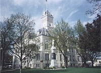
The first district was organized in 1865. There are now ninety-five districts, or one to every 140 inhabitants. The first schoolhouse cost about $50; the last, that of Clay Centre, cost $25,000. From a school population of about 24 when the first school was taught, it has increased in sixteen years to about 5,000. The increase in school property in the same time from $50 to nearly $90,000, shows more conclusively than any other comparison, the prevailing interest in the cause of education.
The school system of the county is a good one, and the schools generally are in a flourishing condition. The standard of qualification of teachers is gradually advancing and is now quite equal to that of counties in the older States. Township and county normals and institutes are held at intervals during the year. The progress here in education has been remarkable and if the active interest in the cause is maintained, Clay County will ere long become a model not only for the West but for the East.
Until 1862, Manhattan and Junction City were the nearest post-offices. During this year the first mail route in Clay County was established. This route was from Manhattan to Clifton, passed along the river valleys, with the offices in the county. The first was on Mall Creek, and the first postmaster was Lorenzo Gates; the second at Clay Centre, with Orville Huntress as postmaster; and the third office at Clifton, was kept by James Fox. The first trip on this route was made by James E. Parkerson on the 1st day of July, 1862. It was at first a weekly mail (and often weakly in amount of matter) but was afterwards a tri-weekly. Junction City later became the southern terminus of the route.
The Junction City & Fort Kearney Railroad reached Clay Centre the 12th of March, 1873, which was its northern terminus until 1878, when it was extended to Clifton, where it connected with the Central Branch of the Union Pacific. These roads are now under the same management. This road has been the principal agent in developing so rapidly the interior of Clay County and making Clay Centre one of the best business points west of Topeka. The road commences at Junction City and runs parallel with the Republican River to Clifton, wholly within the valley. The Kansas Central, a narrow gauge railroad, running west from Leavenworth, has reached a point twenty miles west of Clay Centre.
There are four ferries across the Republican: Rock Ford, Air Line Ferry, Morgantown and Wakefield, and four excellent bridges: Clifton, Morganville, Clay Centre and Wakefield.
Statistics
Acres in the county, 422,400; acres taxable, 282,536; under cultivation, 135,240. Number of acres of winter wheat, 28425; rye, 10,250; spring wheat, 20,185; corn, 48,270; barley, 2,295; oats, 14,355; buckwheat, 75; Irish potatoes, 848; sweet potatoes, 33; sorghum, 210; castor beans, 233; flax, 419; broom corn, 397; millet and Hungarian, 2,315; timothy meadow, 72; prairie meadow, 3,108; prairie pasture, 6,643; blue grass pasture, 60.
Number of horses, 4,301; mules and asses, 346; milch cows, 3,549; other cattle, 4,400; sheep, 1,363; swine, 16,501. Number of acres in nurseries, 84. Number of trees in bearing: Apple, 2,475; pear, 354; peach, 75,423; plum, 4,029; cherry, 1,218. Number not in bearing: Apple, 17,654; pear, 676; peach, 65,681; plum, 3,998; cherry, 7,790. In March 1882, the population of the county was 12,237. Clay Centre City had 2,343 people. The most populous of the seventeen townships, are Sherman, 968; Blaine, 739; Clay Centre, 738.
Law and government
Although the Kansas Constitution was amended in 1986 to allow the sale of alcoholic liquor by the individual drink with the approval of voters, Clay County has remained a prohibition, or "dry", county.
Geography
According to the U.S. Census Bureau, the county has a total area of 1,698 km² (655 mi²), of which 1,668 km² (644 mi²) is land and 30 km² (12 mi²), or 1.77%, is water.
Demographics
Clay County's population was estimated to be 8,625 in the year 2006, a decrease of 203, or -2.3%, over the previous six years.
As of the U.S. Census in 2000, there were 8,822 people, 3,617 households, and 2,517 families residing in the county. The population density was 5/km² (14/mi²). There were 4,084 housing units at an average density of 2/km² (6/mi²). The racial makeup of the county was 97.72% White, 0.57% Black or African American, 0.41% Native American, 0.15% Asian, 0.26% from other races, and 0.90% from two or more races. Hispanic or Latino of any race were 0.83% of the population.
There were 3,617 households out of which 30.50% had children under the age of 18 living with them, 59.90% were married couples living together, 6.10% had a female householder with no husband present, and 30.40% were non-families. 27.70% of all households were made up of individuals and 15.40% had someone living alone who was 65 years of age or older. The average household size was 2.39 and the average family size was 2.91.
In the county the population was spread out with 24.90% under the age of 18, 6.70% from 18 to 24, 23.90% from 25 to 44, 23.70% from 45 to 64, and 20.80% who were 65 years of age or older. The median age was 41 years. For every 100 females there were 99.10 males. For every 100 females age 18 and over, there were 95.60 males.
The median income for a household in the county was $33,965, and the median income for a family was $41,103. Males had a median income of $28,817 versus $17,760 for females. The per capita income for the county was $17,939. About 6.80% of families and 10.10% of the population were below the poverty line, including 14.60% of those under age 18 and 8.60% of those age 65 or over.
Cities and towns
Incorporated cities
Name and population (2004 estimate):
Clay Center, 4,381 (county seat)
Wakefield, 868
Clifton, 516, of which a portion lies in Washington County
Morganville, 195
Green, 141
Longford, 89
Vining, 56, of which a portion lies in Washington County
Oak Hill, 34
Unincorporated places
Fact
Idana
Industry
Republican City