In 1885, Kansas passed a herd law whereby the large cattle ranchers could no longer let their cattle run on the open range. It was about this time that people from the east became interested in the northwestern part of the state and settled in the area. It was during this time the town of Bird City was begun. The town was named for Benjamin Bird, a manager of the Northwest Cattle Company, whose headquarters were twenty miles north of the new town. (In March 1885, there were 204 people in the territory - by March 1886, there were 1256 people in the territory.)
On April 1, 1886 , Governor John A. Martin issued a proclamation declaring that the unorganized county of Cheyenne was to become a bona fide county. (It was named after the Cheyenne Indians that roamed the western plain at that time.) The Governor designated Bird City as the temporary county seat.
The original settlement in the county, Wano, was a trading post (located about one and one half miles northeast of where St. Francis is now located). Wano was an island town, so everything had to be freighted in by horses, mules and oxen from the towns of Haigler and Benkelman, located in Nebraska.
The railroad dream was becoming a reality by 1887. The grade survey stakes were even put in place and the site for the depot was chosen. (Located on the south side of Wano) Captain A.L. Emerson, an employee of the Lincoln Land Co., was instrumental in getting the railroad built at the present location. (The Lincoln Land Co. was known for purchasing land near proposed railroads and starting new towns on their land.) Captain Emerson was owner of the Log Chip Ranch which was located one and one half miles south of Wano (where St. Francis is now located), and was making serveral trips to Lincoln, Nebraska.
The citizens believed he was convincing the railroad to have Wano become a division station. At the time, the citizens assumed that the railroad would continue on to Pueblo, Colorado. This assumption was dashed when a representative of the Lincoln Land Company came to Wano in July and pulled all the stakes up. By November, the land company told the citizens that if they would "move out where we want you to, we will give you a round house and make the NEW Wano a division station."
In late November, the new town site was surveyed and plotted. The people of Wano decided to accept lots in the new town and free transportation for their buildings to be moved to the new site. The actual move to the new site began December 5, 1887, and the last building moved from Wano on May 2, 1888 .
The new town was named St. Francis. The actual origin of the name is unknown, but there are three theories: 1) For Fannie, the wife of Captain Emerson, 2) For Frank, the deceased brother of Captain Emerson, or 3) For J. Francis, an official of the railroad.
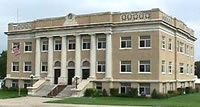
On March 2, 1889, the County Commissioners met to canvas the county for the election which would decide the permanent county seat. St. Francis was elected to be the county seat. On June 3, 1903 , the city of St. Francis was incorporated.
On May 31, 1935, the Republican River, which flows by St. Francis and through the northwestern part of the county, reached its highest crest in history. Nineteen persons lost their lives in the worst flood of the county's history. Flood waters that were a mile to a mile and a half wide swept past St. Francis at 3:00 a.m. They cleared the valley of buildings, bridges, trees and highways, as the flood coursed a new path diagonally across the county.
This history from the City's Web site.
Geography
St. Francis is located at 39°46'17N, 101°48'3W (39.771389, -101.800717). According to the United States Census Bureau, the city has a total area of 2.2 km² (0.9 mi²), all land.
Demographics
As of the census of 2000, there were 1,497 people, 669 households, and 426 families residing in the city. The population density was 680.0/km² (1,771.2/mi²). There were 766 housing units at an average density of 347.9/km² (906.3/mi²). The racial makeup of the city was 97.80% White, 0.20% African American, 0.07% Native American, 0.47% Asian, 0.07% Pacific Islander, 0.53% from other races, and 0.87% from two or more races. Hispanic or Latino of any race were 2.27% of the population.
There were 669 households out of which 25.3% had children under the age of 18 living with them, 54.7% were married couples living together, 6.7% had a female householder with no husband present, and 36.2% were non-families. 34.8% of all households were made up of individuals and 20.8% had someone living alone who was 65 years of age or older. The average household size was 2.16 and the average family size was 2.76.
In the city the population was spread out with 21.7% under the age of 18, 6.1% from 18 to 24, 21.9% from 25 to 44, 18.9% from 45 to 64, and 31.4% who were 65 years of age or older. The median age was 45 years. For every 100 females there were 91.2 males. For every 100 females age 18 and over, there were 83.4 males.
The median income for a household in the city was $30,842, and the median income for a family was $36,250. Males had a median income of $25,484 versus $19,167 for females. The per capita income for the city was $16,714. About 8.9% of families and 11.8% of the population were below the poverty line, including 18.3% of those under age 18 and 8.4% of those age 65 or over.